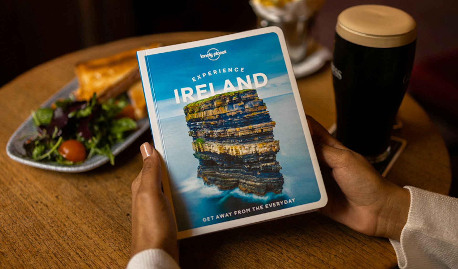
Hiking in Ireland means gentle hills, rocky ridges, wild moorlands, spectacular sea cliffs, remote islands and unpredictable weather, making it an unforgettable life experience.
Here are 12 of the best walks in Ireland to get you planning, plus some top tips on the rules, and what to take.
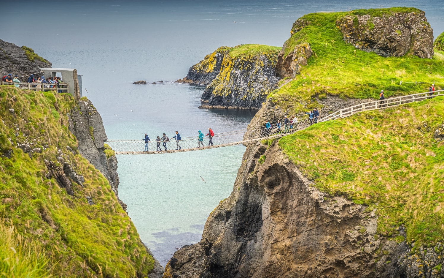
The Causeway Coast Way, County Antrim, passes famous historic sites
33 miles (53km), 2–3 days
This waymarked trail follows Antrim's north coast. Particularly spectacular is the final 10 miles (16.5km) from Carrick-a-Rede to the Giant's Causeway. This section can be done in a day and offers one of the finest coastal walks in Ireland. Leave lots of extra time for excursions; this trail skirts some of Northern Ireland's best-loved tourist attractions like Dunluce Castle and Bushmills Distillery.
Wicklow Way near Dublin has beautiful scenery
79 miles (127km), 5–7 days
Wicklow Way is one of Ireland's most popular long-distance walks because of its remarkable scenery and its relatively accessible start and finish points. Setting off from Dublin’s Marlay Park, you will hike through the heart of the Wicklow Mountains and all the way to Clonegal in County Carlow.
There are plenty of half- and full-day options along the way, with the trail crossing through forest, rivers, rolling hills and more strenuous mountain treks.

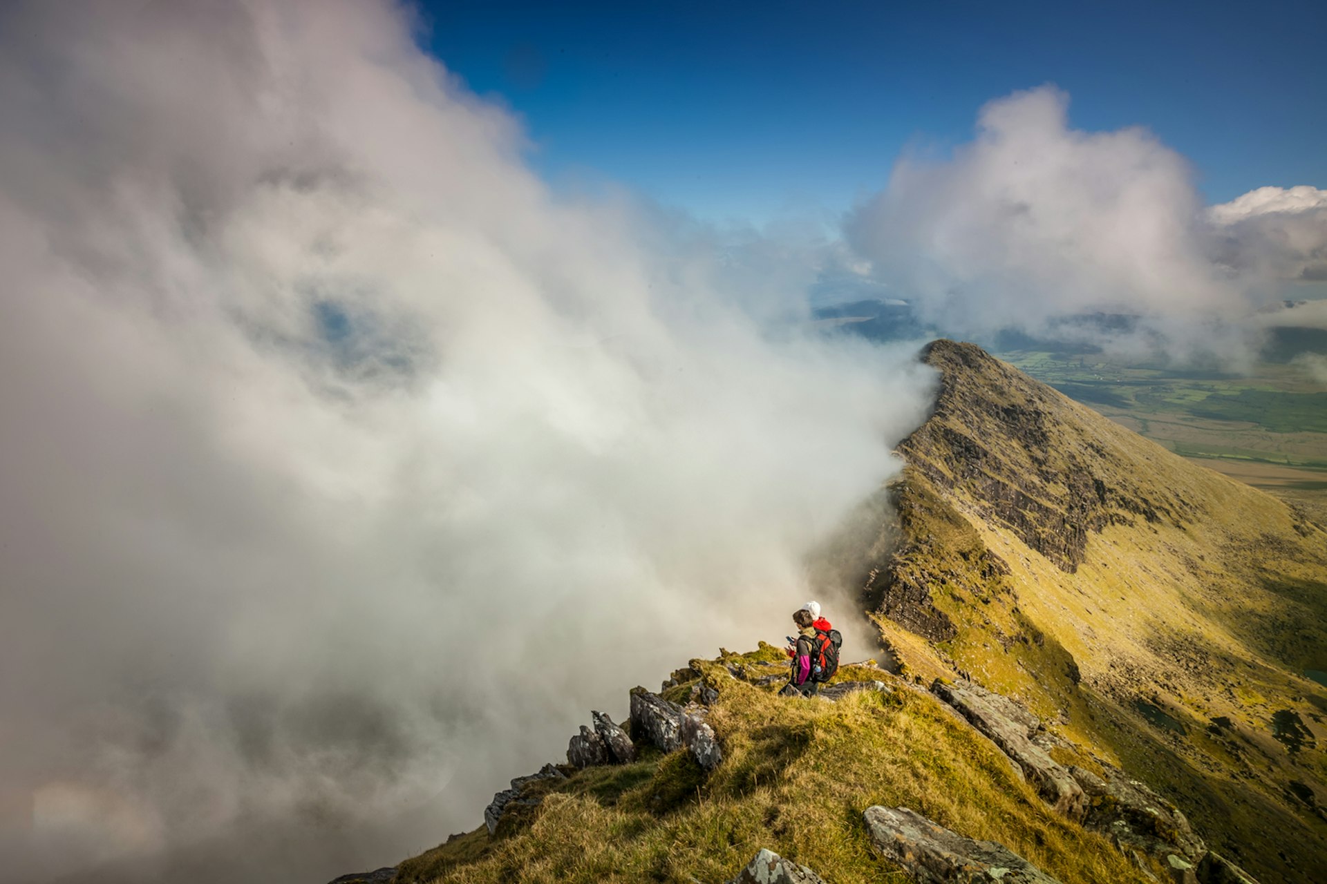
Carrauntoohil, County Kerry, is the best mountain hike
7.5 miles (12km) to summit, 4–6 hours
Carrauntoohil is the country's highest summit, at 1040m (3412ft). There are several routes up, though even the most straightforward requires good hillwalking and navigation skills, while others are serious scrambling or rock-climbing routes. If you don’t have good map-reading and compass skills – or are even slightly unsure – hire a guide.
Carrauntoohil is one of 27 peaks in the Macgillycuddy's Reeks mountain range and there are more manageable mountains to climb for different abilities. The area is full of lakes, forests and spectacular views so you won’t be short on places to explore.
Slieve Donard, County Down, has wonderful sunrise views
3 miles (4.6km) at its most direct route, 2.5 hours
Slieve Donard is the highest point in the Mourne Mountains. On a clear day you’ll have a view of a huge area of Ulster and sometimes even out to Scotland. The 100-year-old Mourne Wall cuts through the valleys and summits for 22 miles (35km) and you can use that as a trail marker to explore more of the region.
Mt Brandon, County Kerry, is Dingle's highest point
6–9 miles (9–15km) depending on the route, 4–6 hours
Mt Brandon, the highest peak on the Dingle Peninsula, has rugged trails that yield jaw-dropping views. It stands in splendid isolation to the north of Dingle, a complex ridge bounded by spectacular cliffs and glacial lakes to the northeast, and falling steeply into the sea to the northwest. In clear weather the views are stupendous.
Howth Summit is the best short hike near Dublin
4 miles (6km), 2 hours
A looped walk around the headlands begins at Howth DART station – follow the green arrow along the promenade and then turn right onto the cliff path. The walk takes you up to the summit before looping back down again. There are other, longer walks marked by blue, red and purple arrows (which partially overlap the green route). This walk will give you incredible views of Dublin Bay, but be prepared to share them with other hikers, especially at weekends when it can get crowded.
Muckross Lake Loop Trail, County Kerry, is perfect for photographers
6 miles (9.5km), 2 hours
Although short, you could easily spend most of a day ambling around this loop trail (anticlockwise only for cyclists), which takes in some of the most photogenic parts of Killarney National Park. There are lovely side trails to explore on the way; don't miss the 10-minute diversion to Old Weir Bridge, where you can watch tour boats powering through the narrow, rocky channel.
Sprawling over 10,236 hectares, the park is an idyllic place to explore with plenty of other more strenuous hiking trails for anyone wanting to see more of the ancient oak woods or find panoramic views of its highest mountains.
Kilcornan Woodland, County Galway, is the best hike near Galway
3.6 miles (6km), 1.5 hours
A wonderfully wild forest, the walkway running through the middle of Kilcornan Woodland is paved, making it easy to navigate with wheelchairs. You can also go off the path with nearby forest trail routes. It’s near impossible to get lost, making it a pleasant afternoon stroll for families as well.
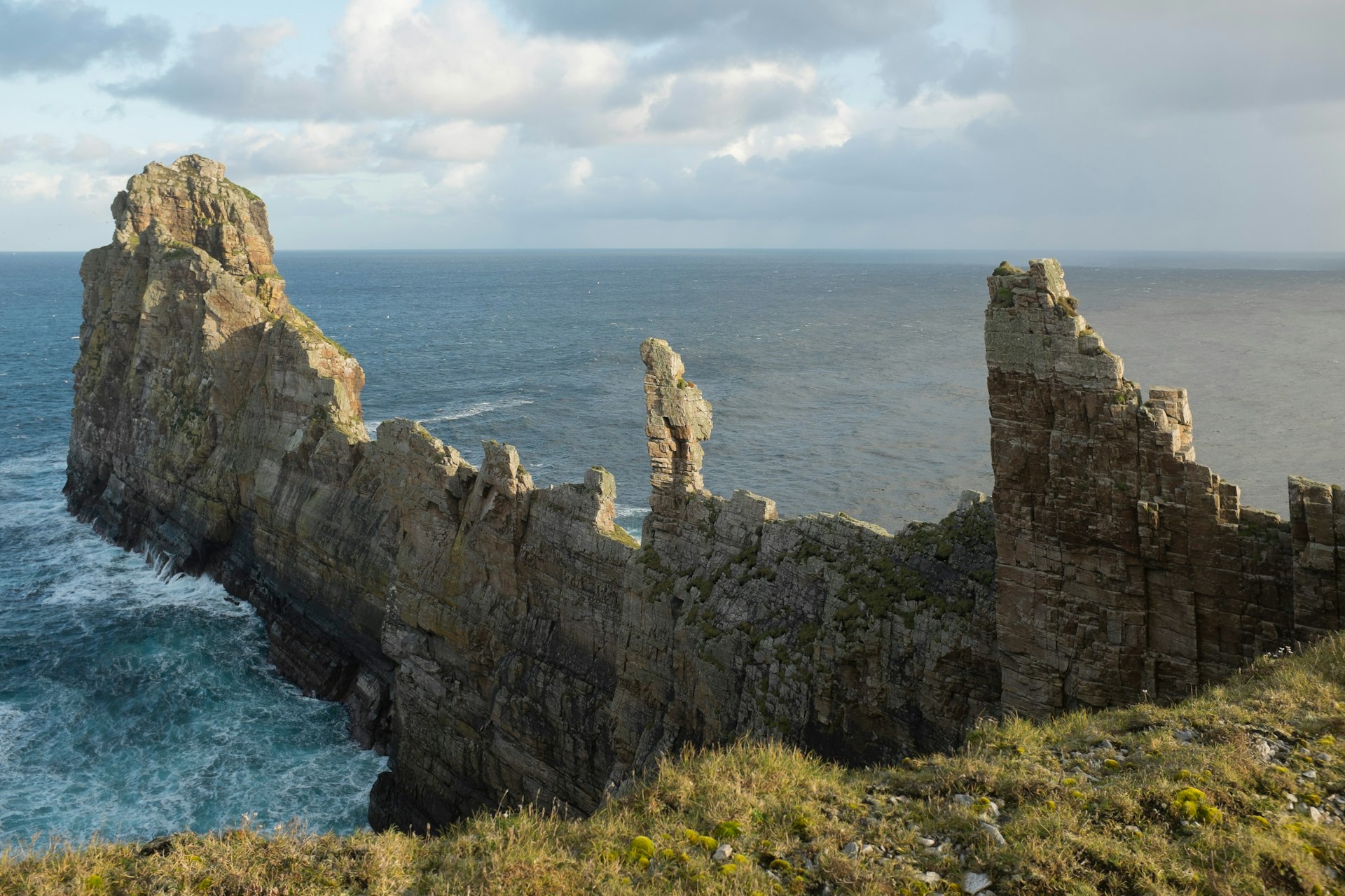
Tory Way, Tory Island, County Donegal, is the best remote walk
5 miles (8km), 2–3 hours
This waymarked loop brings you around Ireland’s most remote inhabited island. The eastern end of the island is dominated by jagged cliffs and sea stacks, including the spectacular Tor Mór, a 1312ft-long (400m-long) blade of rock capped with pinnacles.
Slieve Bloom Mountains, County Offaly, has great walks for families
Distances vary
Straddling Offaly and Laois, there are a number of walking trails in the Slieve Bloom nature reserve ranging from easy 2.5 mile (4km) loops to the multi-day 47 mile (75km) Slieve Bloom Way. The easier ones are great for children with lots of opportunities to spot birds and wildflowers.
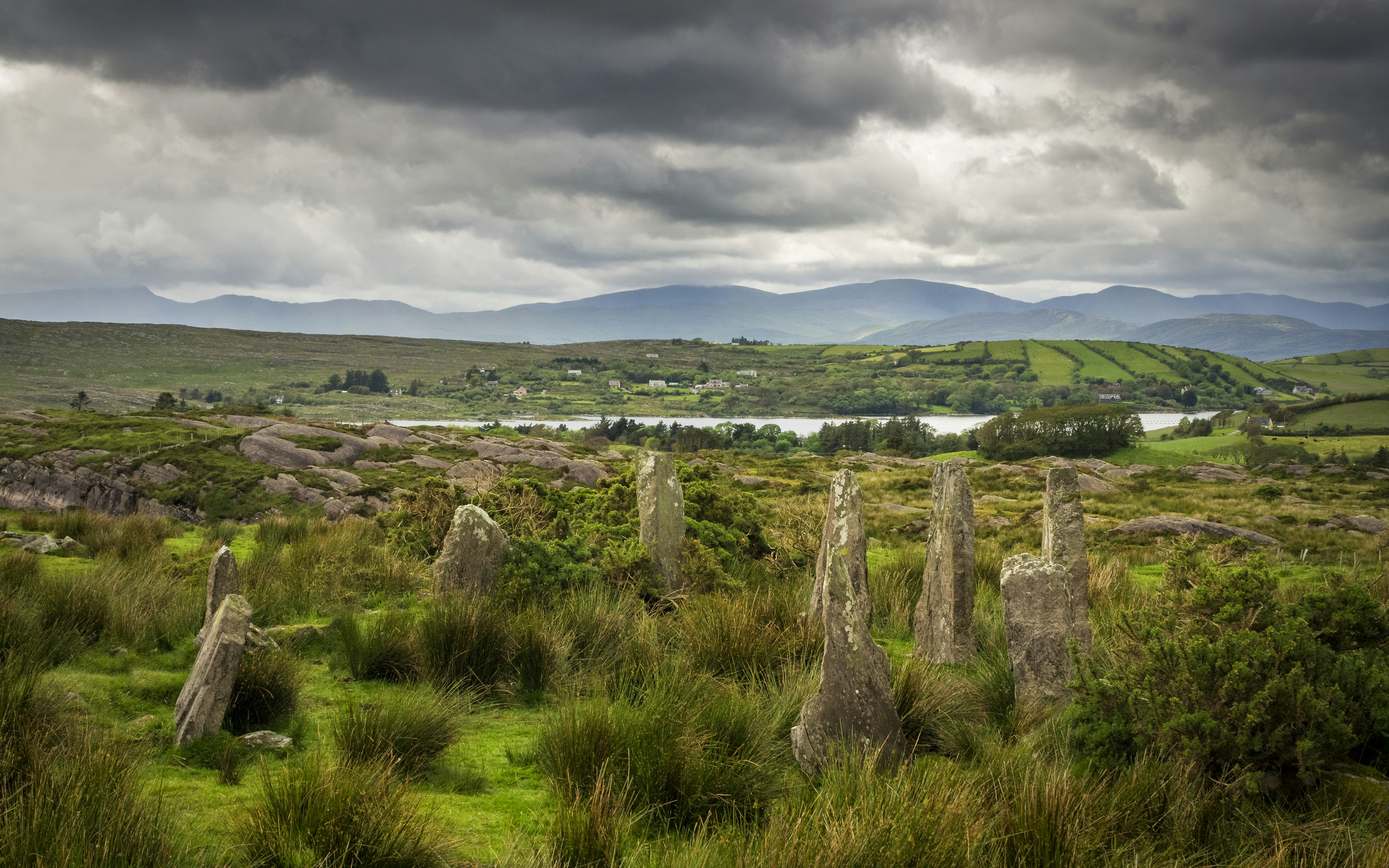
The Beara Way is the perfect route for archaeology lovers
128 miles (206km), 7–10 days
Breara Way waymarked walk forms a loop around the Beara Peninsula. The area is relatively unused to mass tourism and makes a pleasant contrast to the Ring of Kerry to the north. The route mostly follows old roads and tracks, rarely rises above 1115ft (340m) and takes in some of the incredible Wild Atlantic Way coastline. The landscape is dotted with stone circles and archaeological sites dating from the Bronze Age, making this a great hike for history buffs.
Croagh Patrick, County Mayo, is the best mountain hike in the west of Ireland
4.4 miles (7km), 4 hours
The main path up Croagh Patrick ascends the mountain from the signed car park in the west end of Murrisk. The steep trail is rocky in parts and it gets crowded on sunny weekends. At the summit you'll find a 1905 whitewashed church and a 9th-century oratory fountain. The views are sublime. Walkers are advised not to use the traditional Pilgrim’s Path due to high levels of erosion.
Top tips for hiking in Ireland
- May, June and September are the best months for hiking and cycling – this is when you stand the greatest chance of dry weather and less chance of midges.
- There are mountain hikes and waymarked trails suitable for every ability in Ireland and local tourist offices have maps and leaflets with details of local walks near you.
- Unlike most other European countries, walkers and cyclists in Ireland have no rights of access to privately owned land, not even on wild moorland and mountains (unless it is part of a national park). Access has been negotiated with landowners for many national trails and waymarked walks (disputes over access is why many of these trails follow public roads for long distances). However, you will occasionally come across locked gates, barbed-wire fences or "no walkers allowed" signs – these are legal and must be obeyed.
- For short walks on waymarked trails all you will need is comfortable footwear, a rain jacket and some food and water. Hikers venturing further into Ireland's hills and bogs should be properly equipped and cautious, as the weather can become vicious at any time of year.
- After rain, peaty soil can become boggy, so always wear stout shoes or boots and carry good waterproofs and extra food and drink.
- Always take a map and compass and know how to use them. Don’t depend on mobile phones (though carrying one with you is a good idea). Leave a note outlining your route and expected time of return with a trusted person and let them know when you have returned safely.